


FlightHub 2 Business 1 Mounth - Dji
Aerial Imaging > Drones accessories
EAN:6941565960900
€ 97,54 + VAT
€ 119,00 VAT Included
Adcom - Dji
New
Available in 15 days
DJI FlightHub 2 Business 1 Month - CP.RJ.00000100.01
- Livestream: 2000 additional minutes for each connected drone, plus 20,000 minutes for each connected Dock
- Real-time mapping: 3000 additional mapping images for each connected drone
- Cloud storage: 200 GB of additional storage for each connected Dock
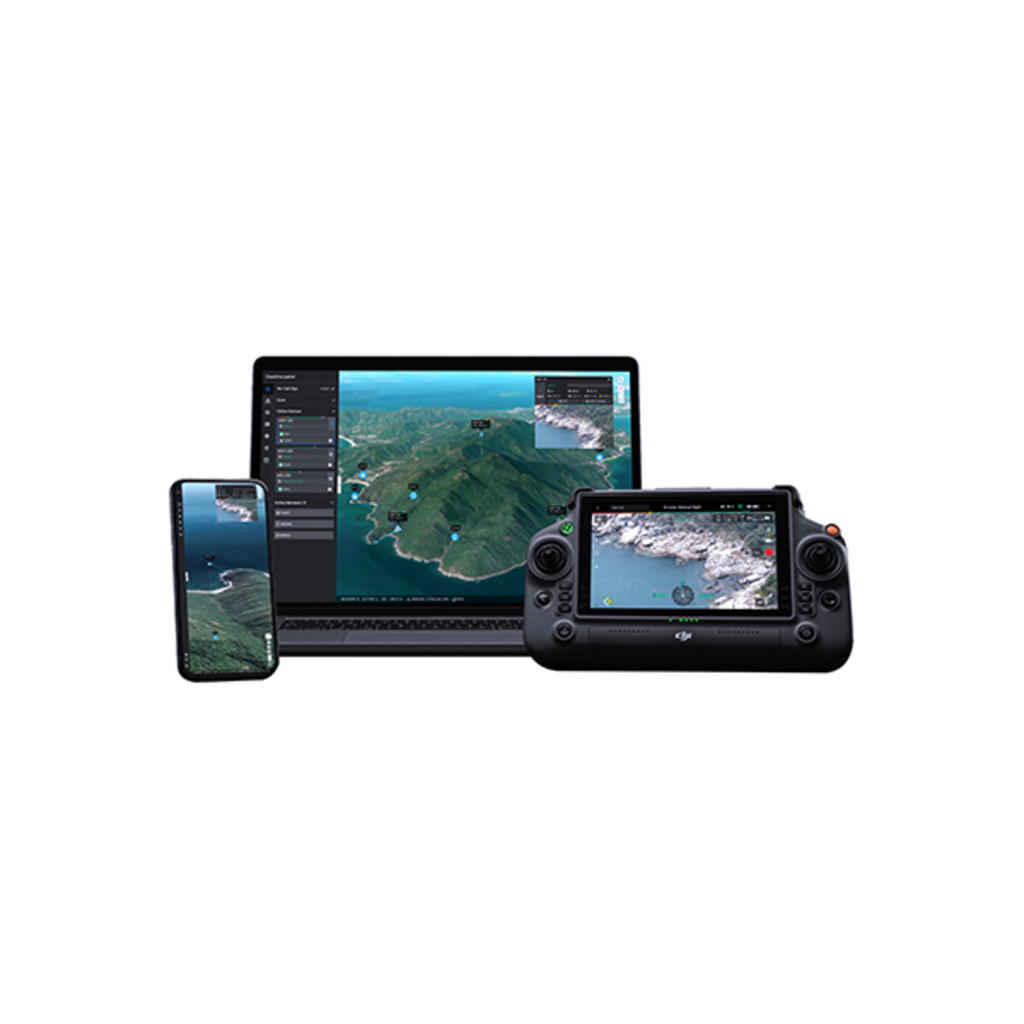
FlightHub 2 is an all-in-one cloud-based drone operations management platform that helps you gain complete, real-time situational awareness. Access all the information you need to plan drone missions, oversee your fleet, and manage the data you create, now from a secure cloud-based environment.
2.5D Basemap
Integrate elevation data with satellite maps to bring terrain awareness to your operations planning.
One-touch panorama sync
Create a 360° panorama and upload it to the cloud with a single tap.
Shared panoramas, along with the coordinates from which they were captured, are inserted into your mission's 2.5D basemap, providing rapid aerial awareness for all team members.
Cloud mapping
Generate RGB or infrared orthomosaics of areas up to 1.5 km in a single flight2.
Orthomosaics are automatically overlaid on your 2.5D basemap, providing detailed awareness of your mission environment whenever needed.
Live mission streaming
Connect multiple users to one or more drone operations simultaneously and keep teams updated on the latest developments with low latency and high-resolution live streaming.
- Livestream: 2000 additional minutes for each connected drone, plus 20,000 minutes for each connected Dock
- Real-time mapping: 3000 additional mapping images for each connected drone
- Cloud storage: 200 GB of additional storage for each connected Dock
FlightHub 2 is an all-in-one cloud-based drone operations management platform that helps you gain complete, real-time situational awareness. Access all the information you need to plan drone missions, oversee your fleet, and manage the data you create, now from a secure cloud-based environment.
2.5D Basemap
Integrate elevation data with satellite maps to bring terrain awareness to your operations planning.
One-touch panorama sync
Create a 360° panorama and upload it to the cloud with a single tap.
Shared panoramas, along with the coordinates from which they were captured, are inserted into your mission's 2.5D basemap, providing rapid aerial awareness for all team members.
Cloud mapping
Generate RGB or infrared orthomosaics of areas up to 1.5 km in a single flight2.
Orthomosaics are automatically overlaid on your 2.5D basemap, providing detailed awareness of your mission environment whenever needed.
Live mission streaming
Connect multiple users to one or more drone operations simultaneously and keep teams updated on the latest developments with low latency and high-resolution live streaming.


